Innovative and participative approach to traffic safety

Summary
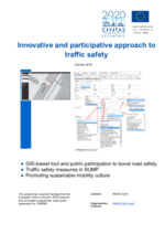
A comprehensive road safety study will be undertaken in the demonstration area, supported by the development of an application (based on Geographical Information Systems (GIS)) for mapping road safety incidents. The public will be encouraged to report on road safety hazards and incidents using apps, and this information will feed the GIS-based application. Citizens will also engage in other road safety actions in the city labs. The GIS-based tool will also serve to monitor traffic safety measures included in the SUMP.